Volkswagen software used to optimize urban planning
In a pilot project in the USA, a software developed by the Volkswagen Group's Smart.Production:Lab analyzes city traffic flows; the data can be used for intelligent urban planning.
Urbanization is one of the most important global trends: today more than four billion people live in urban areas, which is more than half of the world's population. Managing this huge increase in density requires smart urban planning, and "Software is the only way to achieve this", says Markus Zarbock, Head of Technology at the Volkswagen Group's Smart.Production:Lab. His team is working on intelligent robotics and software for automotive production; from these activities came the Volkswagen Vision Workbench (VW²), a software that recognizes and processes images.
"Originally, we developed it for visual quality control in production and logistics, to let colleagues quickly check that the materials were all there or that the labels were affixed correctly. A solution that makes work easier and saves time", Zarbock explains.
Going further with software
The Smart.Production:Lab is part of the Software Innovation Center, a hub for IT innovations for the entire Volkswagen Group. "We are inventors and therefore always curious about whether it is possible to go even further", Zarbock adds.
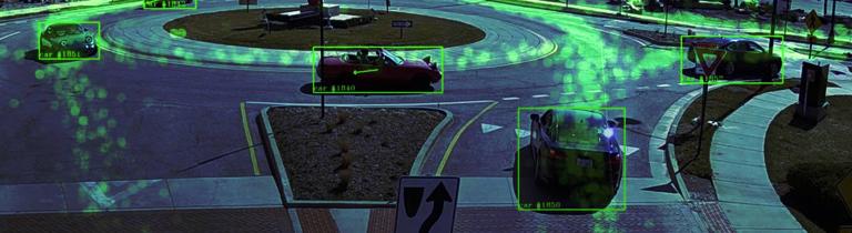
And that is exactly what has happened with the software (VW²) currently being used by Volkswagen and Scania specialists in a research project in the United States to analyze traffic in the city of Carmel, Indiana. Here, simply put, the software uses cameras to record the flow of traffic in the city, thus creating an extensive database. The data is then analyzed by artificial intelligence (AI) and used to optimize the transport infrastructure.
Value data
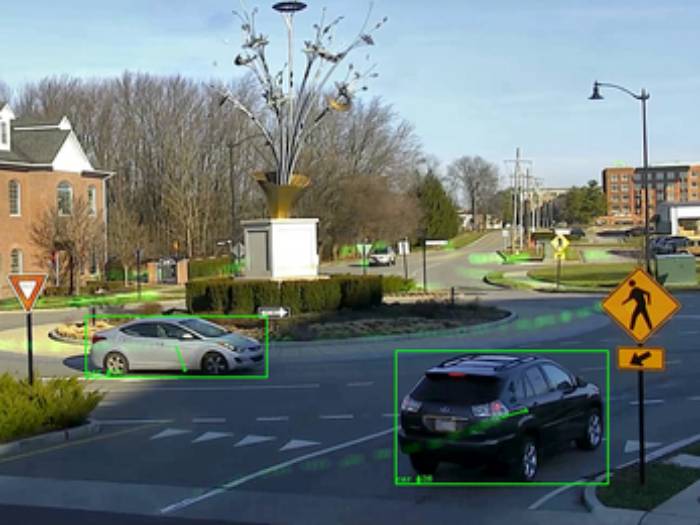
"Like many cities, Carmel has a network of public cameras that, among other things, record traffic and have been used primarily for security purposes so far", resumes Zarbock, who then explains how through this project information will also be generated for data-driven traffic planning.
Knowing data on the amount of cars, bicycles, and pedestrians present provides valuable information for infrastructure planners, allowing them to analyze road use patterns, optimize traffic flow, and support emergency procedures. It is possible to see where parking spaces are needed, which bus routes are needed, or where traffic flow can be diverted during peak times.
The software and the urban environment
But the urban environment, a new operating context for the software, also presents some challenges: "A factory is a very controlled environment and it is easy to predict what will happen there. But on a road, anything can happen: in the case of a wild animal crossing the road, our algorithm was not prepared to recognize it", continues Zarbock, who then describes how the team searched for images of different animals in the area and taught the software to recognize them.
This also allows them to identify areas where wild animals are most present and regularly cross the road, so they can report sightings to vehicles in the surrounding area almost in real time.
Anonymous and useful data
Volkswagen developers have implemented a dashboard that uses graphics and maps to display aggregated traffic movements, processing the data anonymously thanks to software that automatically "pixelates" people's faces. Even license plates are blurred, and no video recordings are stored, only the computational information.
This data is also useful to the Carmel municipality, which wants to introduce new public transportation options. Current and detailed movement patterns of vehicles, people, and goods will allow to suit the needs of the city and its residents, while information on hazards zones will also reduce the risk of accidents. The data can also facilitate the work of police and fire brigades, because thanks to updates every ten seconds, traffic is depicted almost in real time.
Faster rescue and smart transportation
"This is of great help in specific traffic situations, such as large-scale events or public emergencies", Zarbock further adds. All this allows first responders to react more quickly to accidents and emergency situations. The next step involves installing this technology on more roads to create an optimal test environment and consequently a suitable amount of data to define a traffic model for the city.
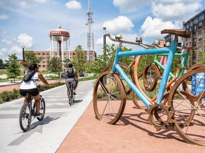
Preferred routes of cyclists and electric cars will also be analyzed to intelligently expand cycle paths and charging infrastructure. "For this, the cameras need to be able to identify different types of vehicles", Zarbock explains. The project is the first of its kind for Volkswagen globally, but it is just the beginning, as this software could be used for various multimodal transportation solutions around the world.
Developing the software
"Software development is an iterative process, which means that we're continuously improving our algorithms and want to push them to the limit", Zarbock concludes. Carmel is a perfect place for this kind of research because it sees all four seasons alternating, which means the cameras have to prove they work not only in bright sunshine but also in frost, fog and snow.
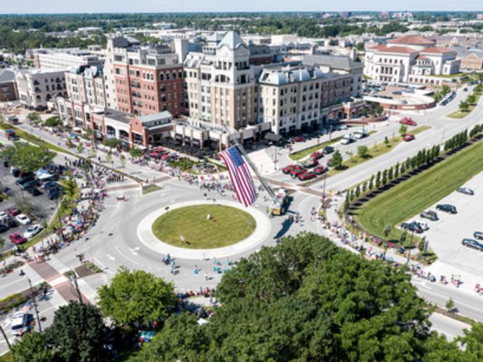
Carmel is used to innovations: in 1924 it was the first city to have electric traffic lights in the U.S.; today, however, it is the city with the most traffic roundabouts (over 140) in the entire United States. The population is just over 100,000, which is more than four times larger than thirty years ago. This rapid growth makes new urban planning necessary.
Source: Volkswagen - Shaping Mobility Hub
VGI | Responsible OU: VP | Creation date: article date | Class 9.1